Jane Sutterlin and Maria Wherley, both instructional designers in the John A. Dutton E-education Institute, will discuss how technology and learning science can improve teaching. The webinar will be broadcast from 10 to 11 a.m. EST on Wednesday, July 28.
In 2020, Penn State and the University of Freiburg launched a pilot program to create collaborative, integrated virtual classroom courses by providing development and implementation money to faculty teams.
Penn State's College of Earth and Mineral Sciences (EMS) recognized exceptional students and faculty for their academic excellence, service and leadership during its annual Wilson Awards Celebration, held virtually on Sunday, April 11. The Wilson Awards are named in honor of Matthew and Anne Wilson, major benefactors of the college.
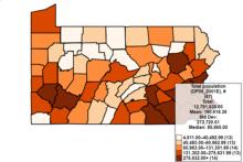
Recent Master of Geographic Information Systems graduate Nate Geyer has always been interested in epidemiology and geography. As a research support assistant in the Department of Public Health Sciences in the College of Medicine, he was able to put those interests together by creating a new version of the LionVu cancer mapping tool.
As one of the pioneers of online instruction at Penn State, David DiBiase watched for three decades as programs offered through the John A. Dutton e-Education Institute broadly expanded access to education.
Todd Bacastow, teaching professor in the College of Earth and Mineral Sciences at Penn State, has been appointed to the board of directors of the United States Geospatial Intelligence Foundation (USGIF) for a three-year term.
Barbara DeClerck knows which way the wind blows. A meteorologist with the National Weather Service, DeClerck provides daily wind forecasts to help airplanes land on time at one of the busiest airports in the world.
OPEN.ED is a website hosting high-quality learning materials written by faculty in the College of Earth and Mineral Sciences that are free for educators and learners under a creative commons license.
More and more companies are using location data from devices like smartphones and tablets to gain insights into choices consumers make.


