

As the use of location-based data becomes more pervasive and complicated, we need experts who can leverage spatial data to develop insights and improve decision-making. The Penn State Master of Science in Spatial Data Science (SDS) can prepare you to work at the forefront of the geospatial industry, where Geographic Information Systems (GIS) and spatial analysis intersect with the principles of data science, visualization, and programming.
What you can learn
As a student in this completely online program, you can learn to:
- Leverage the science of spatial analysis and modeling to develop new workflows to solve problems that impact people and our planet
- Architect and implement solutions that blend computational and visual approaches
- Research, communicate, and critique data quality and the results of spatial analyses
Careers
Graduates of this program can pursuing a senior-level career in business, public health, emergency management,natural resources, transportation, energy, or urban development. The following roles are often held by people with this type of degree:
- Geographic Data Visualization Specialist
- Geospatial Analyst
- GIS Software Developer
- GIS/Geospatial Data Engineer
- Spatial Data Scientist

At first glance, Haley Sankey doesn’t seem a likely candidate for the Pennsylvania Game Commission’s appointed board of commissioners.
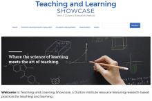
The John A. Dutton e-Education Institute has launched the Teaching and Learning Showcase, a web-based resource designed to help faculty members create inspiring educational materials and experiences.
- Hometown:

Jane Sutterlin and Maria Wherley, both instructional designers in the John A. Dutton E-education Institute, will discuss how technology and learning science can improve teaching. The webinar will be broadcast from 10 to 11 a.m. EST on Wednesday, July 28.

In 2020, Penn State and the University of Freiburg launched a pilot program to create collaborative, integrated virtual classroom courses by providing development and implementation money to faculty teams.