Penn State will begin offering massive open online courses through FutureLearn, the United Kingdom’s leading MOOC platform, as part of the organization’s launch in the United States.
WPSU Penn State’s “Women in Science Profiles” features five local women working in STEM-related professions. The series aims to inspire young women to enter STEM-related fields while dispelling misconceptions about STEM professionals and their lives.
Penn State geography student Travis Young is researching why low-income neighborhoods in Houston are the only ones in the area at high risk for flooding. His research interests stem from many factors in his personal and professional life.
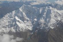
A Penn State professor is researching the trickle-down effects that melting tropical glaciers have on food security and biodiversity, and what regional communities, like Cusco and Huaraz in Peru, can do about it.
Conservation and logging groups in Central and West Africa are failing to fully incorporate local concerns into management, marginalizing the livelihoods of the local population, according to Nathan Clay, doctoral candidate in geography, Penn State.
Give yourself an edge in the field of geospatial intelligence by pursuing a master of professional studies in homeland security, geospatial intelligence option. Our program, offered online through Penn State World Campus, is designed to increase the skills and knowledge of the analyst to produce accurate intelligence to help save lives, improve government, and assist businesses.
Careers
Graduates of this program can work for federal government agencies or any employer with the need for mapping, management, and analysis of geographic data. Common job titles of graduates include geospatial analyst, geospatial Intelligence specialist, senior imagery analyst, imagery analyst intelligence analyst, spectral analyst, and GEOINT data specialist.
Information systems are a core component of any research, educational, or industrial enterprise in the Earth and materials sciences. In addition, the science and engineering disciplines represented in the college have a particular focus on numerical modeling and simulation systems, and on the analysis and management of very large data sets. The EMS - IST minor provides students a basic introduction to information sciences and information technology through courses in the core curriculum of the College of Information Sciences and Technology. Students then select from a group of interdisciplinary EMS courses that focus on the particular interests of the college.
Minor is only open to students enrolled in the College of Earth and Mineral Sciences.
The Master of Geographic Information Systems (M.G.I.S.) degree is awarded to students who demonstrate mastery of the technical competencies and leadership skills required to design, manage, and use geographic information technologies successfully in a wide range of professional fields. The M.G.I.S. program is intended specifically for working professionals who are able to participate only on a part-time basis and at a distance.
Program Options
You can choose to pursue a specialized option in:
- Geospatial Intelligence (GEOINT) Option — Produce information and insights through skillful and conscientious analysis of diverse geo-referenced data to manage natural and cultural assets, enforce the law, and plan and conduct military operations.
- Geodesign (GEODZ) Option — Combine science and evidence-based approaches with the design process, enabling you to become more adept at assessing the impact of designs on people and nature.
Careers
- Environmental resource management
- Urban and regional planning
- Local government
- Surveying and cartography
- Facilities management
- Transportation planning
This certificate was designed to help geospatial professionals become skillful developers of software for the GIS and mapping industries. These skills include the ability to script the automation of geospatial business processes, to develop custom user interface tools on top of existing desktop applications, and to author web-based mapping applications that support the exploration and analysis of geospatial datasets. Such skills are in high demand in the geospatial industry. This program is designed specifically for geospatial practitioners who seek formal education in geospatial programming and web mapping for the purposes of advancing their professional development or seeking a career change. It covers software development in the uniquely geospatial context using a mixture of proprietary and open source languages and technologies.


