Chapter 14

THE URBAN HEAT ISLAND EFFECT

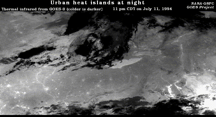
Goals: To quantify the urban heat island effect during both the daytime and during the night, for both winter and summer, for several cities, using daily and monthly mean temperatures.


Data:

  1. Daily maximum (high) and daily minimum (low) temperatures for December, January and February (representing winter) and June, July and August (representing summer) for two years for downtown Wilkes-Barre, PA, and the nearby, less urban Wilkes-Barre/Scranton International Airport:

  2. Monthly mean minimum temperatures and mean annual minimum temperatures for the period 1900-1994 for downtown Baltimore, MD, and for Woodstock, MD, a nearby, more rural observing site:


Procedure:

  1. For each downtown-rural pair, use the available data to estimate the magnitude of the urban heat island effect in winter during the daytime. Then do the same for nighttime.

  2. For each downtown-rural pair, use the available data to estimate the magnitude of the urban heat island effect in summer during the daytime. Then do the same for nighttime.

  3. For these locations, is the urban heat island effect greater during the day or at night? Is the urban heat island effect greater during winter or summer?

  4. Consider this figure, which is similar to Figure 14.24 in the text. Based on various geographical features, can you identify the part of the country that is being viewed? What geographical features can you identify? What cities can you identify?

Other "Weather on the Web" Exercises

Chapter 1 | Chapter 2 | Chapter 3 | Chapter 8 | Chapter 9| Chapter 10 | Chapter 11 | Chapter 12